Drone Mapping & Photogrammetry
Drone Mapping & Photogrammetry
1 Question
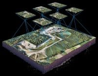
Answers to common drone mapping and photogrammetry questions, including GCP planning, RTK vs PPK, GSD calculation, flight parameters, accuracy assessment, and coordinate systems for mapping surveys.


