Home
Surveying
GIS
UAVs & Drones
Photo & RS
News
Survey Tools
Coordinate Area & Perimeter Calculator
WGS 84 Lat Lon Converter
WGS UTM Zone Finder
EPSG Code Finder
Time Zone Finder
Jobs
Geomatics Events
Search
Explore
Explore
Home
Surveying
GIS
UAVs & Drones
Photo & RS
News
Survey Tools
Coordinate Area & Perimeter Calculator
WGS 84 Lat Lon Converter
WGS UTM Zone Finder
EPSG Code Finder
Time Zone Finder
Jobs
Geomatics Events
Search
Explore
Explore
UAVs & Drones
Crafting Standard Operating Procedures (SOPs) for Drone – Based Pesticide Application in Precision Agriculture
Staff Writer
March 13, 2026
UAVs & Drones
Drone Conferences & UAV Events in Africa 2026: Where Innovation, Policy, and Impact Meet
Staff Writer
January 25, 2026
UAVs & Drones
The Global Drone Events Calendar 2026: Conferences, Expos, and Industry Forums
Staff Writer
January 23, 2026
UAVs & Drones
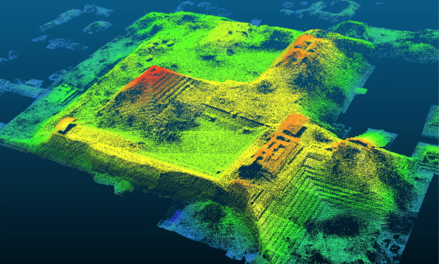
What is LiDAR and How Surveyors Use It with Drones
Staff Writer
December 16, 2025
Photo & RS
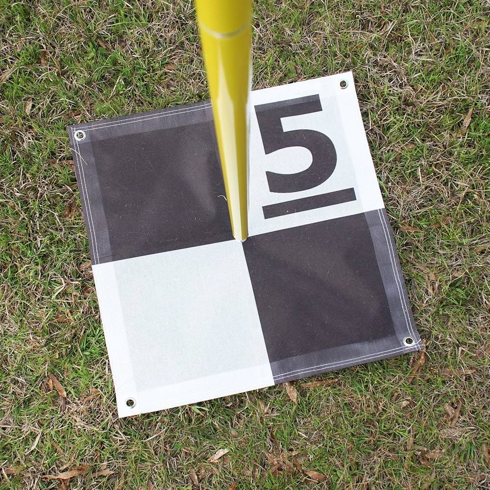
How to Plan Accurate Drone Surveys with Ground Control Points (GCPs)
Staff Writer
November 11, 2025
GIS
From Satellites to Smart Streets: How Geomatics is Shaping Smart Cities and the UN Sustainable Development Goals
Staff Writer
October 23, 2025
UAVs & Drones
Aerobotics in Africa: How Drones & AI Are Transforming Farming (with Ken Treloar
Staff Writer
October 13, 2025
UAVs & Drones
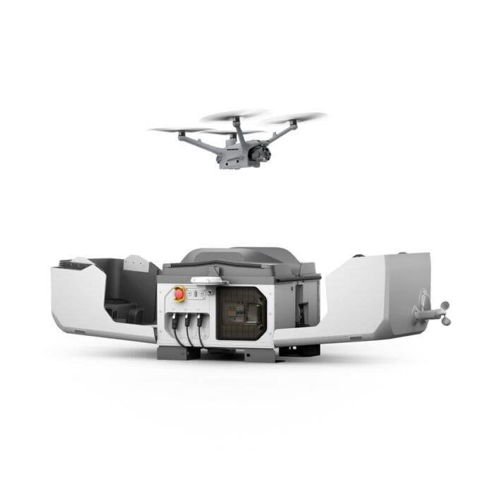
Drone Docking Stations Explained: The Future of Automated Drone Operations
Staff Writer
September 16, 2025
GIS
News
From Field Frustration to Innovation: How a Zimbabwean GIS Graduate Built TGIS Collector for Remote Mapping
Staff Writer
June 9, 2025
UAVs & Drones
Ghana Drone Industry Overview: Licensing Process, UAV Training, Market Development and Future Opportunities
Staff Writer
June 5, 2025
1
2
Facebook
23k
Likes
YouTube
100k
Subscribers
LinkedIn
436
Followers
TikTok
50
Followers
Popular Posts
GIS
News
From Field Frustration to Innovation: How a Zimbabwean GIS Graduate Built TGIS Collector for Remote Mapping
Staff Writer
June 9, 2025
Surveying
Precision and Innovation: The Future of Geomatics and Surveying
April 28, 2025
Surveying
Understanding The Role Of Surveyors In Construction Projects
May 5, 2025
UAVs & Drones
The Global Drone Events Calendar 2026: Conferences, Expos, and Industry Forums
January 23, 2026
Jobs & Opportunities
GIS & Information Management Consultant – Map Action: Mozambique
January 29, 2026
Drone Pilots & Assistants x 8 – (UK & Ireland)
December 26, 2025
GIS Intern: Cicada
June 9, 2025
Geospatial Researcher (Remote)
April 29, 2025
Post Categories
GIS
2 Articles
News
1 Articles
Photo & RS
2 Articles
Surveying
2 Articles
UAVs & Drones
8 Articles
Uncategorized
0 Articles
Recommended Host
Home
Surveying
GIS
UAVs & Drones
Photo & RS
News
Survey Tools
Coordinate Area & Perimeter Calculator
WGS 84 Lat Lon Converter
WGS UTM Zone Finder
EPSG Code Finder
Time Zone Finder
Jobs
Geomatics Events
Trending Stories
Weekly Newsletter
Subscribe to our newsletter to get our news & updates
I consent to the terms and conditions
© Copyright 2025 Geomatics Central. All rights reserved


