
Compared to its predecessor, the Zenmuse L1, DJI’s improved Zenmuse L2 lidar sensor has higher accuracy and efficiency. Due to its affordability and ever-increasing accuracy of data, drone lidar has been becoming more and more popular.
The new Zenmuse L2 comes with some cool features such as:
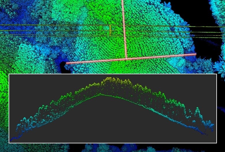
- Five returns, which enable it to capture additional ground points in areas with a lot of vegetation.
- Increased Precision (5cm Horizontal Accuracy & 4cm Vertical Accuracy)
- Greater Detection Range (450m at 50% reflectivity and 250m at 10% reflectivity)
- Increased Efficiency (able to cover up to 2.5 km2)
- Strong Penetration (smaller laser spots)
The new DJI Zenmuse L2 has another intriguing feature: unlike the previous DJI Zenmuse L1, it doesn’t require warming up. Instead, mapping can begin as soon as the aircraft is turned on, as long as the RTK signal is fixed.
Both repetitive and non-repetitive scanning modes are available for the L2. While the repetitive mode provides more consistent and accurate point clouds while satisfying high precision mapping requirements, the non-repetitive mode provides deeper penetration for more structural information. Powerline inspection, forestry surveying, and other situations are appropriate for the non-repetitive mode.
Source: DJI Website


