Home
Surveying
GIS
UAVs & Drones
Photo & RS
News
Survey Tools
EPSG Code Finder
Free Coordinate Area & Perimeter Calculator
WGS 84 Lat Long Coordinate Converter
WGS UTM Zone Finder
Jobs
Forum
Search
Explore
Explore
Home
Surveying
GIS
UAVs & Drones
Photo & RS
News
Survey Tools
EPSG Code Finder
Free Coordinate Area & Perimeter Calculator
WGS 84 Lat Long Coordinate Converter
WGS UTM Zone Finder
Jobs
Forum
Search
Explore
Explore
Home
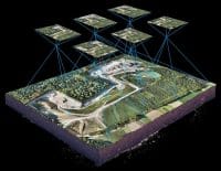
What overlap is recommended for drone mapping surveys?
What overlap is recommended for drone mapping surveys?
22 views
2 hours ago
Drone Mapping & Photogrammetry
drones
0
Staff Writer
4
2 hours ago
0
Comments
Facebook
Email
X
LinkedIn
WhatsApp
Telegram
What’s the recommended overlap I should use?
Facebook
Email
X
LinkedIn
WhatsApp
Telegram
Staff Writer
Asked question
2 hours ago
0
Answers
Active
Voted
Newest
Oldest
Register
or
Login
Facebook
23k
Likes
YouTube
100k
Subscribers
LinkedIn
436
Followers
TikTok
50
Followers
Popular Posts
GIS
News
From Field Frustration to Innovation: How a Zimbabwean GIS Graduate Built TGIS Collector for Remote Mapping
Staff Writer
June 9, 2025
Surveying
Precision and Innovation: The Future of Geomatics and Surveying
April 28, 2025
Surveying
Understanding The Role Of Surveyors In Construction Projects
May 5, 2025
UAVs & Drones
Photo & RS
5 Fatal Drone Mapping Mistakes You Should Never Make
January 21, 2025
Jobs & Opportunities
Environmental Geospatial and UAV Officer – SAERI (Falkland Islands)
December 26, 2025
Drone Pilots & Assistants x 8 – (UK & Ireland)
December 26, 2025
GIS Intern: Cicada
June 9, 2025
Geospatial Researcher (Remote)
April 29, 2025
Post Categories
GIS
2 Articles
News
1 Articles
Photo & RS
2 Articles
Surveying
2 Articles
UAVs & Drones
5 Articles
Uncategorized
0 Articles
Home
Surveying
GIS
UAVs & Drones
Photo & RS
News
Survey Tools
EPSG Code Finder
Free Coordinate Area & Perimeter Calculator
WGS 84 Lat Long Coordinate Converter
WGS UTM Zone Finder
Jobs
Forum
Trending Stories
Weekly Newsletter
Subscribe to our newsletter to get our news & updates
I consent to the terms and conditions
Δ
© Copyright 2025 Geomatics Central. All rights reserved


